Political Map of eastern europe
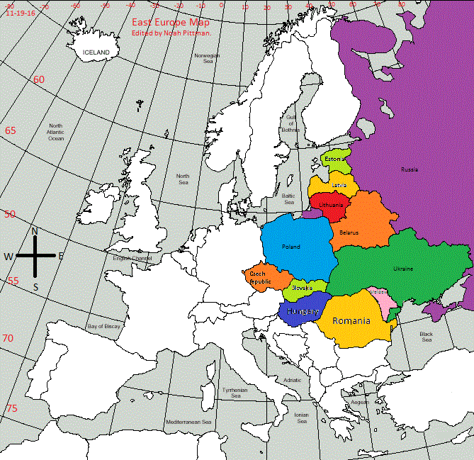
In East Europe, not many border changes happen until the 1912, when the Ottoman empire, a country that primarily existed on the coast of the Mediterranean, lost most of its land in europe, including Romania, Moldova, Russia, and Ukraine, because of the Balkan wars. 5 years later, Poland, Lithuania, Latvia, and Estonia declared independence. A year later, hungary is formed. In 1922, the Soviet Union is formed in land that is now owned by Russia. Finally, in 1939, the world war II is started. That year, Poland is taken over by Germany, and part of lithuania is ceded to Germany. Throughout the whole war, the Soviet union losses and gains major pieces of land from Axis powers. At the end of the world war, Both countries have their land returned. No other border changes happen until 1991, when the soviet union is disbanded to form Estonia, Latvia, Lithuania, and Russia. 2 years later the Czechoslovakia turns into Czech Republic and Slovakia. Most ,recently, Russia has taken the Crimean peninsula, claiming that it was because Russia used to control the peninsula, when it was in the Soviet Union.
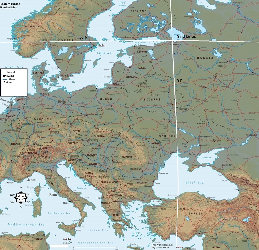
PHYSICAL/political MAP of eastern europe
The Alps form a land border that does separate part of France from Italy and eastern Europe. The Parpathian Mountains border east Europe and to the south of east Europe lies the black sea and Turkey below that. While east Europe may be large in size, many physical features lie to the west as the temperature gets warmer and more land touches the Mediterranean Sea.
MAJOR RIVERS
MAJOR RIVERS
- Volga
- Danube
- Ural
- Ural Mountains
- Balkan Peninsula
- Carpathian Mountains
- Carpathian Mountains
- Scandinavian Mountains
- Southeast Baltic Plains
